


4.71Mb (173 downloads)
FS2000
Arkansas/Louisiana/Mississippi Terrain Mesh Scenery. Made
from USGS Digital Elevation Models (DEM) with Microsoft Terrain
SDK. By Eddie Denney. 4.8MB
Posted Jun 23, 2008 14:35 by archive
5.15Mb (210 downloads)
FS2000
Michigan/Wisconsin Terrain Mesh Scenery. Made from USGS
Digital Elevation Models (DEM) with Microsoft Terrain SDK. By
Eddie Denney. 5.2MB
Posted Jun 23, 2008 14:35 by archive
1.52Mb (208 downloads)
FS2000
Illinois Terrain Mesh Scenery. Made from USGS Digital Elevation
Models (DEM) with Microsoft Terrain SDK. By Eddie Denney. 1.5MB
Posted Jun 23, 2008 14:35 by archive
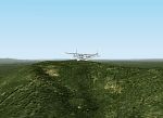
5.80Mb (356 downloads)
FS2000
Southeastern U.S. Terrain Mesh Scenery. Made from USGS Digital
Elevation Models (DEM) with Microsoft Terrain SDK. Covers the
states of Alabama, Florida, Georgia, and South Carolina. By
Eddie Denney. 6MB
Posted Jun 23, 2008 14:35 by archive
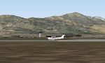
2.18Mb (245 downloads)
Healy
River Alaska,
a paved 3000 ft airstrip near Mt. McKinley National Park, serves
small to medium sized aircraft. For local bush pilots, this
download includes seven other nearby destinations with primitive
facilities. Fairbanks is 62 miles to the north, but Healy River
serves as a good hub where bush passengers can catch the twin
engine commuter on its flight from Anchorage to Fairbanks. by
Dave Erickson. For FS2000. Size 1.8MB
Posted Jun 23, 2008 14:35 by archive
0.22Mb (227 downloads)
FS2000
Canary Islands Terrain Mesh Scenery. Version 1.0 The Canary
Islands are a part of Spain located near to the coast of Morocco.
By Ricard Alvarez. 227K
Posted Jun 23, 2008 14:35 by archive
3.58Mb (282 downloads)
COLORADO
SPRINGS TERRAIN MESH This FS2000 terrain mesh, at 30 meters
horizontal resolution, covers an area including Colorado Springs,
Colorado, USA, and extends west to include Pikes Peak and mountains
nearby, part of the Front Range of the Rocky Mountains. Pikes
Peak, at 14110 ft. (4301 meters), is noted for a commanding
view. By Orlando Sotomayor. 3.6MB
Posted Jun 23, 2008 14:35 by archive
11.56Mb (615 downloads)
FS2000
French Alps altiports scenery by Bernard Martin. Due to
the inclined runways and detailed scenery which had to be put
in the default FS2000 scenery, Bernard has made his scenery
split up to separate files with a complicated manual installation
of 17 diferent sceneries. This package offers all of them ready
to be copied inside tour scenery with a ready configuration
file. Courchevel, Megeve, Meribel, Mont Dauphin, Gap Tallard,
Sallanches, La Rosiere and many other stunning mountain airfields.
Color VFR area chart also included. Packaged by Kyprianos Biris.
11.8MB
Posted Jun 23, 2008 14:35 by archive
0.86Mb (349 downloads)
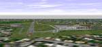
Birmingham
Airport UK for FS2000 (Updated). This is version 2 of the
scenery for Birmingham. The previous scenery had problems with
the ILS on landing. In this version I have recreated the complete
scenery leaving the original ILS of Fs98. This should cure the
problem. If you get any other problem please contact me at the
above address. Also in this version are more accurate taxi lines
and taxi ways. The NEC is still visible at dense settings..
By John Walker. 1.5MB
Posted Jun 23, 2008 14:35 by archive
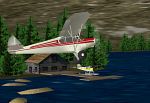
0.39Mb (209 downloads)
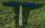
Lake
Timberwolf. Lake Timberwolf lies about 125 miles N.E. of
Valdez, Alaska. It's a very woodsy place, providing excellent
views of some very beautiful mountains. The scenery provides
for both land and water starts, and has abundant wildlife. Fly
on out and see us! Scenery by Don Moser/ Alaska By Don. 396K
Posted Jun 23, 2008 14:35 by archive